Harrison Floyd is a student at Clemson who participated in the Digital Ecologies courses of Materializing Mathematics, Applied Mapping, Smart Materials and Kinetic Structures, and Designing Interactive Environments. The following are samples of his work.
Maurin is a student at Clemson who participated in the Digital Ecologies courses of Community 1:1, Pilot Study, Smart Materials and Kinetic Systems, and Extended Reality. The following are samples of Maurin’s work.
Yuting Lu is a student at Clemson who participated in the Digital Ecologies courses of Studio V, Digital Manufacturing Process, Smart Materials and Kinetic Structure, and Extended Reality. The following are samples of Lu’s work.
Marissa Cutry is a student at Clemson University who participated in the Digital Ecologies course of Smart Materials + Kinetic Structures, Applied Mapping, and Digital Manufacturing Process. The following are samples of her work.
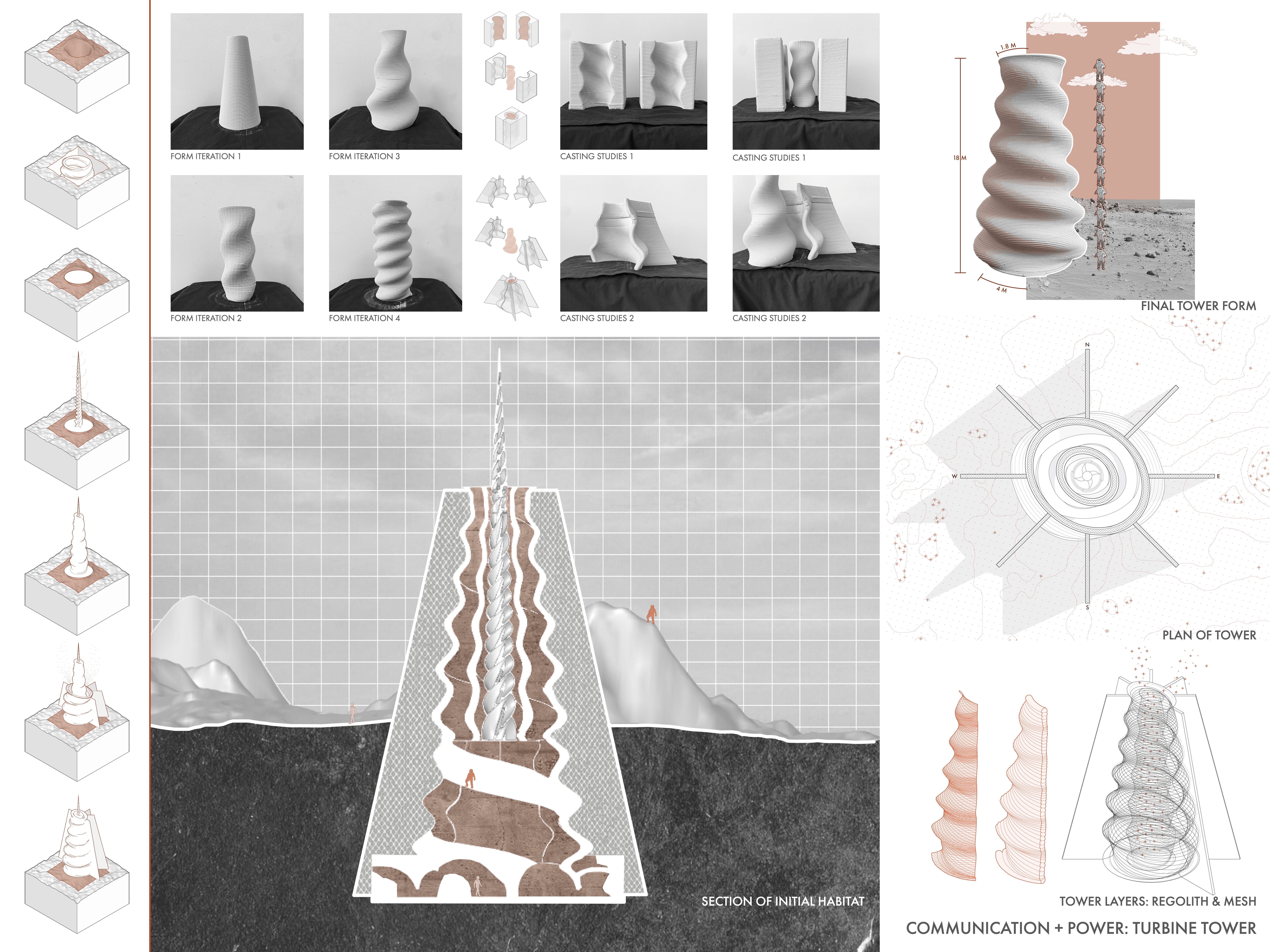
The Moon Studio was offered as an advanced fluid design studio to senior undergraduate and graduate students, led by Dr. Winifred Newman and Shan Sutherland. Students were tasked to think critically about the potential of life on Mars, and to perform deep research into the built limitations of another planet.
Throughout the semester, students performed research into the history and climate of Mars, the evolution of the geological system, and how to prepare for human exploration. Students referenced the “Human Research Program” conducted by NASA as a precedent for exploring life on another planet.
Students studied materials and models suitable for habitation in the climate of Mars. They developed devices, skins, interfaces, and environments that would make life on Mars possible.
Applied Mapping is a graduate level course taught by Dr. Winifred Newman. The course focuses on developing more effective ways to employ mapping by studying them as cartographic histories. In Applied Mapping, students study maps as objects of historical explanation to understand place.
Throughout the semester, students evaluated historical maps, identified map types and their corresponding utility, and collected data to make their owns maps. Students had the opportunity to work with drones to develop their own mapping projects.
The following images are student work created throughout the course of the semester.
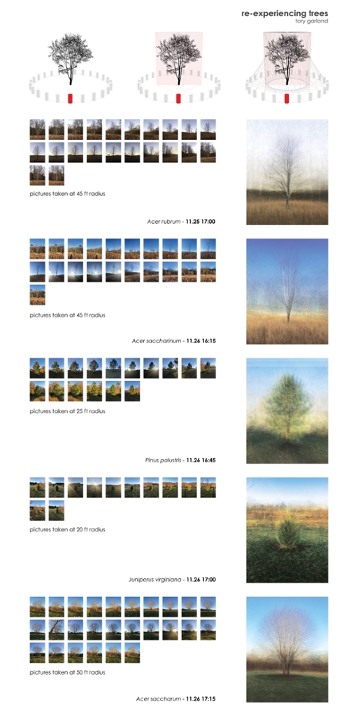
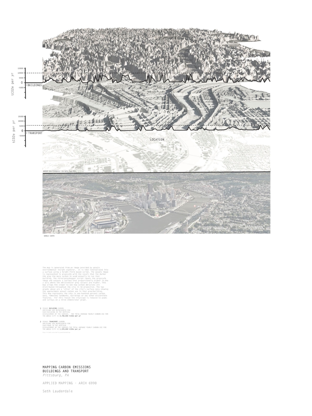
Student Tony Garland created a study of how trees are experienced in different times at different levels. Student Seth Lauderdale studied an image in google earth and dissected it to create multiple maps to explain activity and experience.